Six From Anne Davies

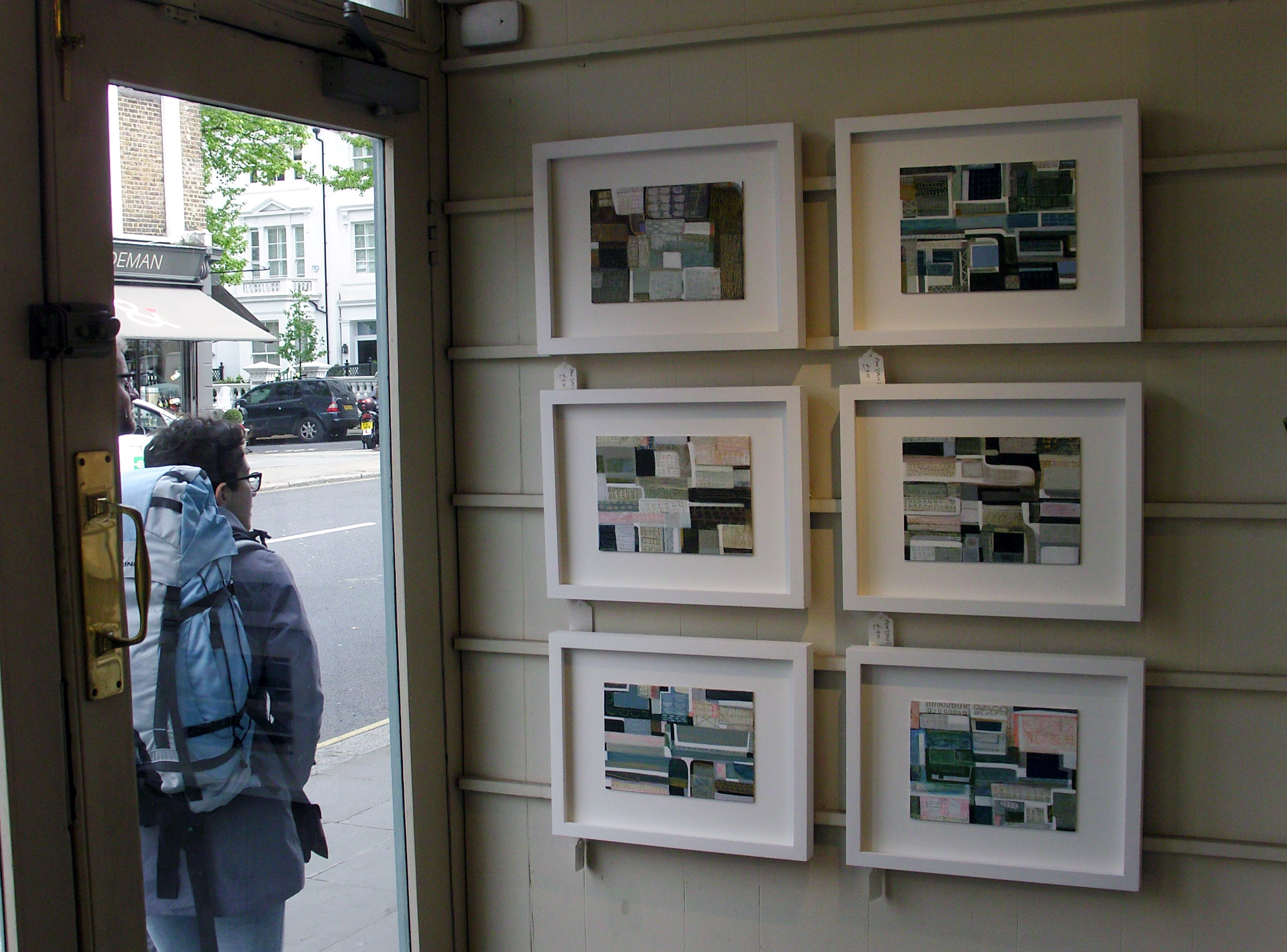
We just hung six new paintings by Anne Davies, though since we had one of them already, strictly speaking I suppose only five are new. But it’s a new sextet. Here’s what Anne said about them –

I spent time walking the Bermondsey Wall to Rotherhithe and then, on the other side, Wapping, Shadwell and Limehouse. Canary Wharf was less inspiring but still interesting in a different way! I was also inspired by the lovely Ewan MacColl song ‘Sweet Thames Flow Softly’. I don’t know if you know it but it tells the tale of two people falling in love along the banks of the river, and then one of them thinks better of it in the end. I recommend the Rufus and Martha Wainwright version! Continue reading “Six From Anne Davies”

Frames of reference

Ankerwycke

IMG_0252

Ankerwycke is a small corner of riverside farmland and historic parkland on the north bank of the Thames at Runnymede. Planes fly over constantly, in and out of Heathrow and there’s a continuous drone from the M25 half a mile downstream, yet this place still remains a hidden green sanctuary. Runnymede gets all the visitors and Ankerwycke gets overlooked. Continue reading “Ankerwycke”

Frames of reference

Messing About On The River (3)

This is The Oarsman’s and Angler’s Map of the River Thames from its Source to London Bridge. It comes rolled in a tube and at one inch to one mile it is 2.5 metres long. It was engraved by E G Ravenstein and first published in 1893. This edition has an introduction by Richard Way, specialist bookseller from Henley on Thames:

…. The Thames flows roughly north west to south east but Ravenstein cleverly elongated this dimension by ironing out the river’s NE SW meanderings. The river is thus contained within an artificial boundary 5 miles wide. The map however retains a true scale along its length. If Ravenstein had represented a geographical reality at this scale the map would be shorter but 4 times wider. Ravenstein presumably selected London Bridge as the end point of the map because it was the last bridge on the river. Tower Bridge opened the year after the map was published.

It would be a difficult piece to frame and an awkward piece to hang. I thought it might be best presented here. Continue reading “Messing About On The River (3)”

Frames of reference